


33125 MACDAY LN Steamboat Springs, CO 80487
42.5 Acres Lot
UPDATED:
Key Details
Property Type Vacant Land
Sub Type Residential
Listing Status Pending
Purchase Type For Sale
Subdivision Beaver Ridge Estates Subdivision
MLS Listing ID S1057113
Annual Tax Amount $7,876
Tax Year 2024
Lot Size 42.500 Acres
Acres 42.5
Property Sub-Type Residential
Property Description
Showings commence May 14, 2025.
Location
State CO
County Routt
Area South And West
Direction From West End of Town: West on 13th Street until it joins with RCR 33. Travel West/Southwest about 10 miles to RCR 43. Turn Left onto RCR 43 at High Tension Power Line Towers and travel East/Southeast about 3 miles to the “top of the hill”, then turn Right onto RCR 43a. Take RCR 43a about 1.5 miles this will turn into Mack Day Lane. Property is second drive on your right (first drive is Single Family home). Agent will meet you at drive just past Chapparel. From Mountain: Mt. Werner West; go under US 40 to first stop sign. Turn Left/South on to RCR 14. Travel South on RCR 14, “veering to the right” as it briefly becomes RCR 35 and then RCR 41. Continue for a several miles until you reach “the little red school house,” and then turn right onto RCR 41. Follow RCR 41 North/Northwest as it becomes RCR 43 after the “elbow turn”. At the “top of the hill” turn left onto RCR 43a. Take RCR 43a about 1.5 miles which will turn into Mack Day Lane. Property is second drive on right.
Interior
Fireplace No
Exterior
Utilities Available Electricity Available, Propane, Sewer Not Available
View Y/N Yes
Water Access Desc Well
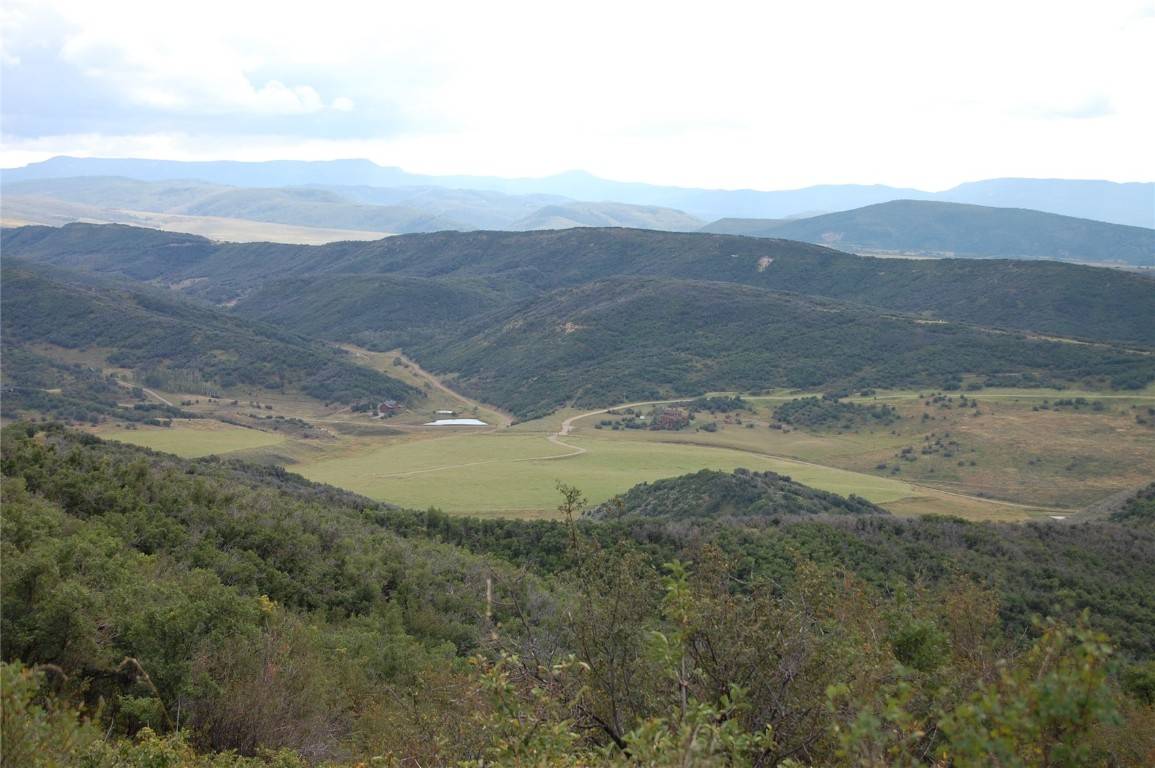
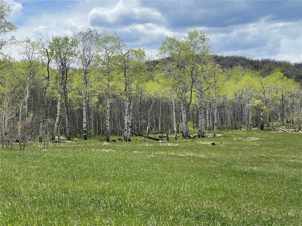
View Meadow, Mountain(s), Pond, Ski Area, Water
Present Use Agricultural,Hunting,Residential,Recreational,Single Family
Street Surface Dirt
Building
Lot Description Borders State Land, Near Ski Area, Open Space, Rolling Slope, Many Trees, Secluded
Sewer None
Water Well
Others
Tax ID R4201183
